"Cities are rarely fragmented by a single decision. More often, they are gradually divided by infrastructure, changing topography and isolated urban development. Landscape has the unique ability to repair these fractures—not only by connecting places, but by reconnecting everyday life."
Restoring the Landscape Between the Hills
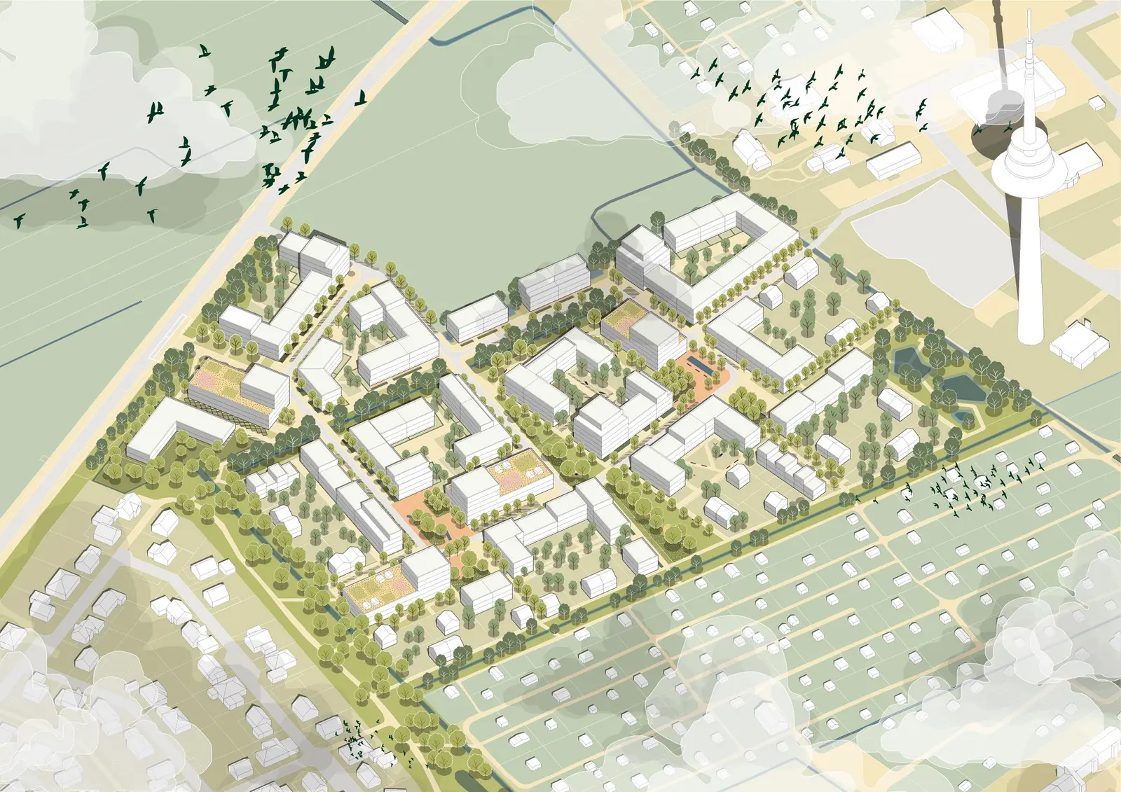
The southeast of Erfurt is characterised by a series of large residential neighbourhoods that were once conceived as independent urban districts. Over time, transport infrastructure, differences in elevation and fragmented public spaces weakened the relationships between them. The valley that originally connected the surrounding hills gradually became dominated by roads, traffic infrastructure and disconnected open spaces, reducing its role as a shared civic landscape.
The Neue Mitte Südost project was developed as part of the Competitive Dialogue for the City of Erfurt to reverse this process. Rather than treating the site as a conventional infrastructure project, the proposal reimagines the central valley as the social, ecological and spatial heart of the district.
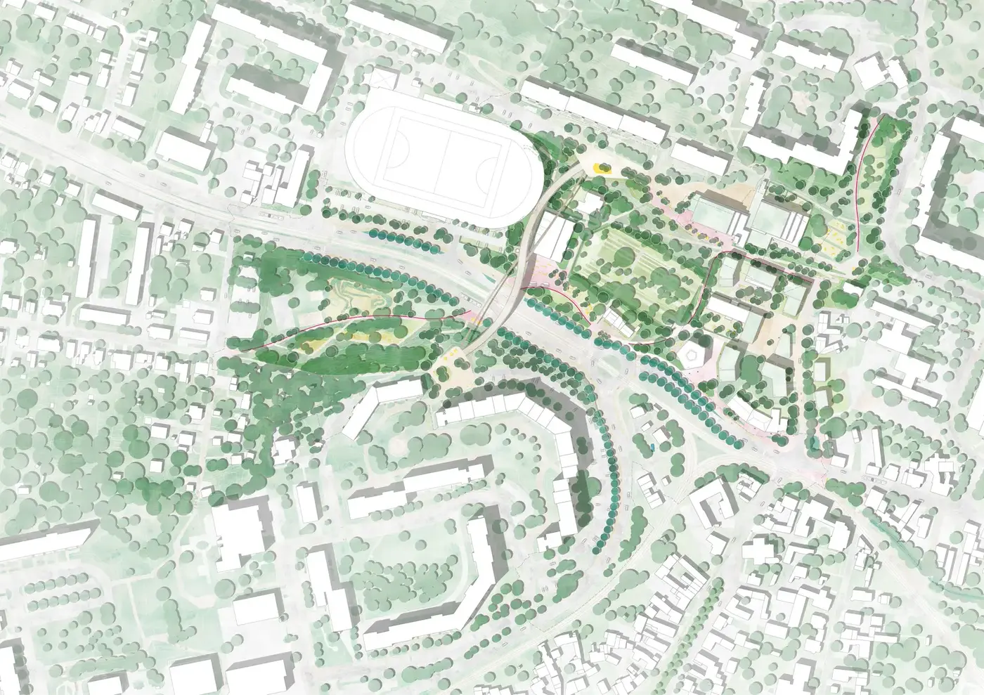
Landscape becomes the primary framework through which movement, ecology, mobility and public life are brought back together. Instead of designing isolated parks and squares, the project establishes a continuous public landscape that reconnects the neighbourhoods of Herrenberg, Wiesenhügel and Melchendorf while creating a new identity for southeast Erfurt. This ambition directly reflects the objectives of the model project: to reconnect the surrounding neighbourhoods, strengthen public spaces and initiate a long-term transformation of the district.
Landscape as the Organising Framework
The project begins with a simple but powerful idea.
Instead of allowing roads and infrastructure to organise the city, landscape becomes the element that structures urban life.
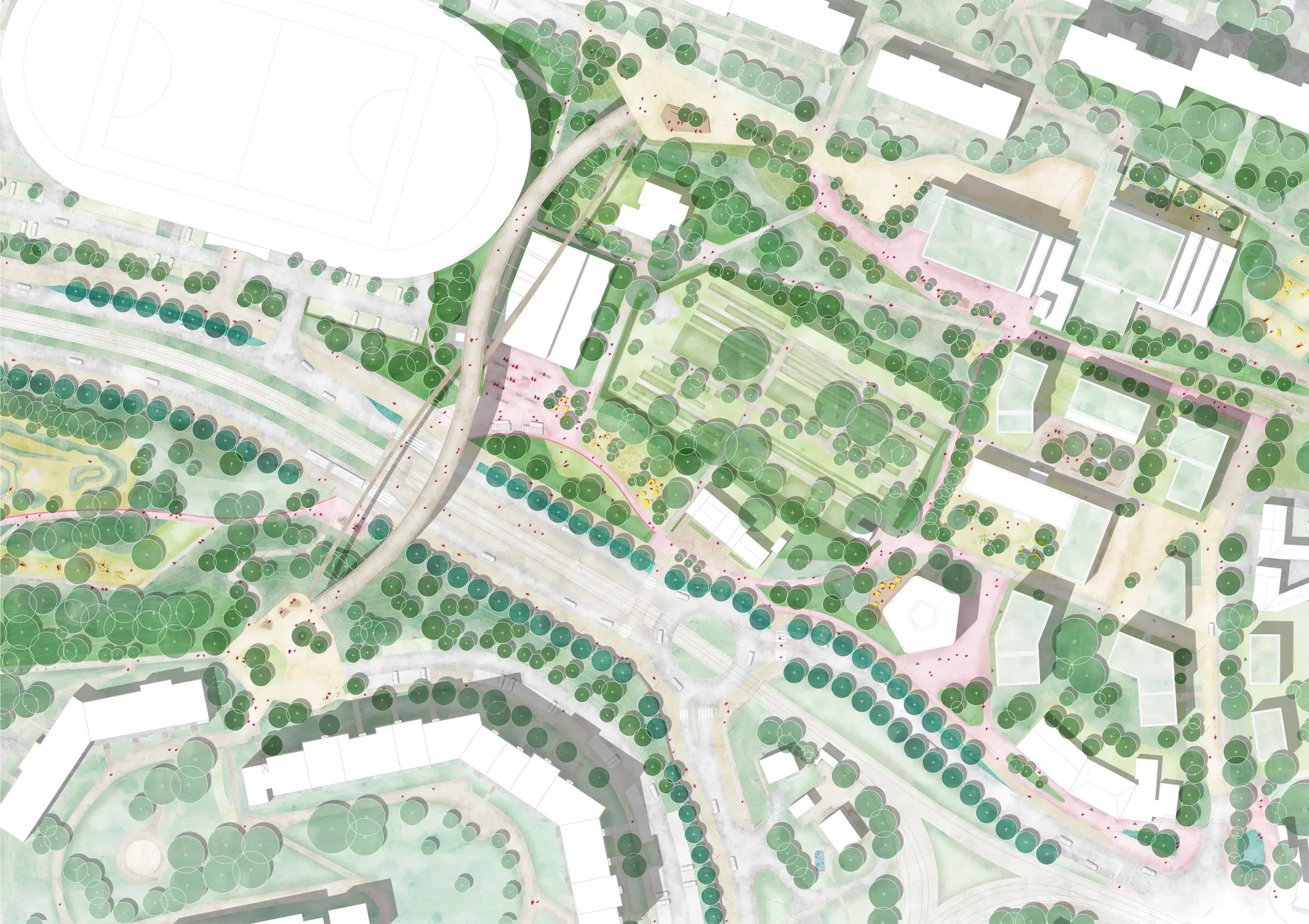
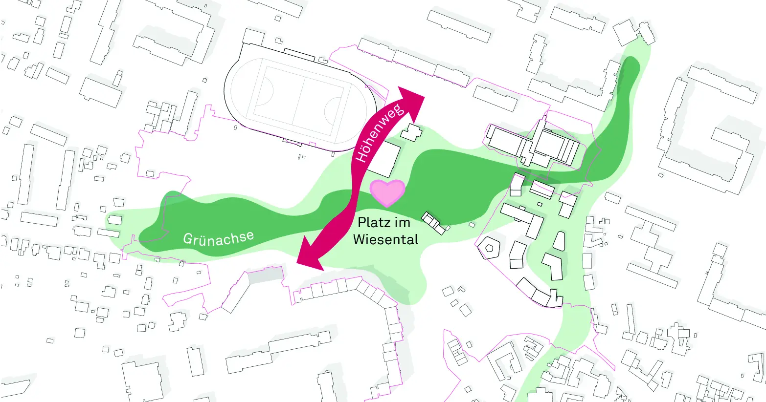
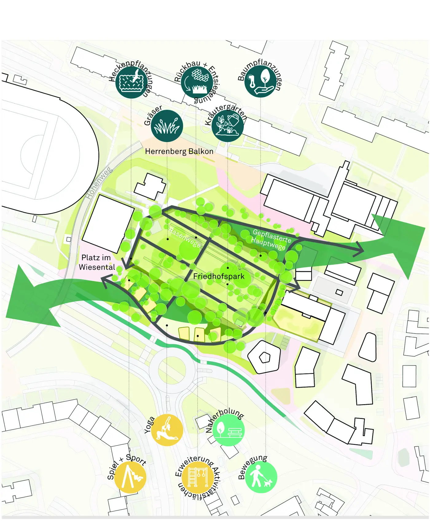
A continuous Landscape Boulevard forms the backbone of the proposal. Following the existing topography, it links all major public spaces through an accessible sequence of paths, terraces and gently sloping connections. Rather than overcoming differences in level, the design embraces them, transforming the terrain into a rich spatial experience that encourages walking, meeting and discovery.
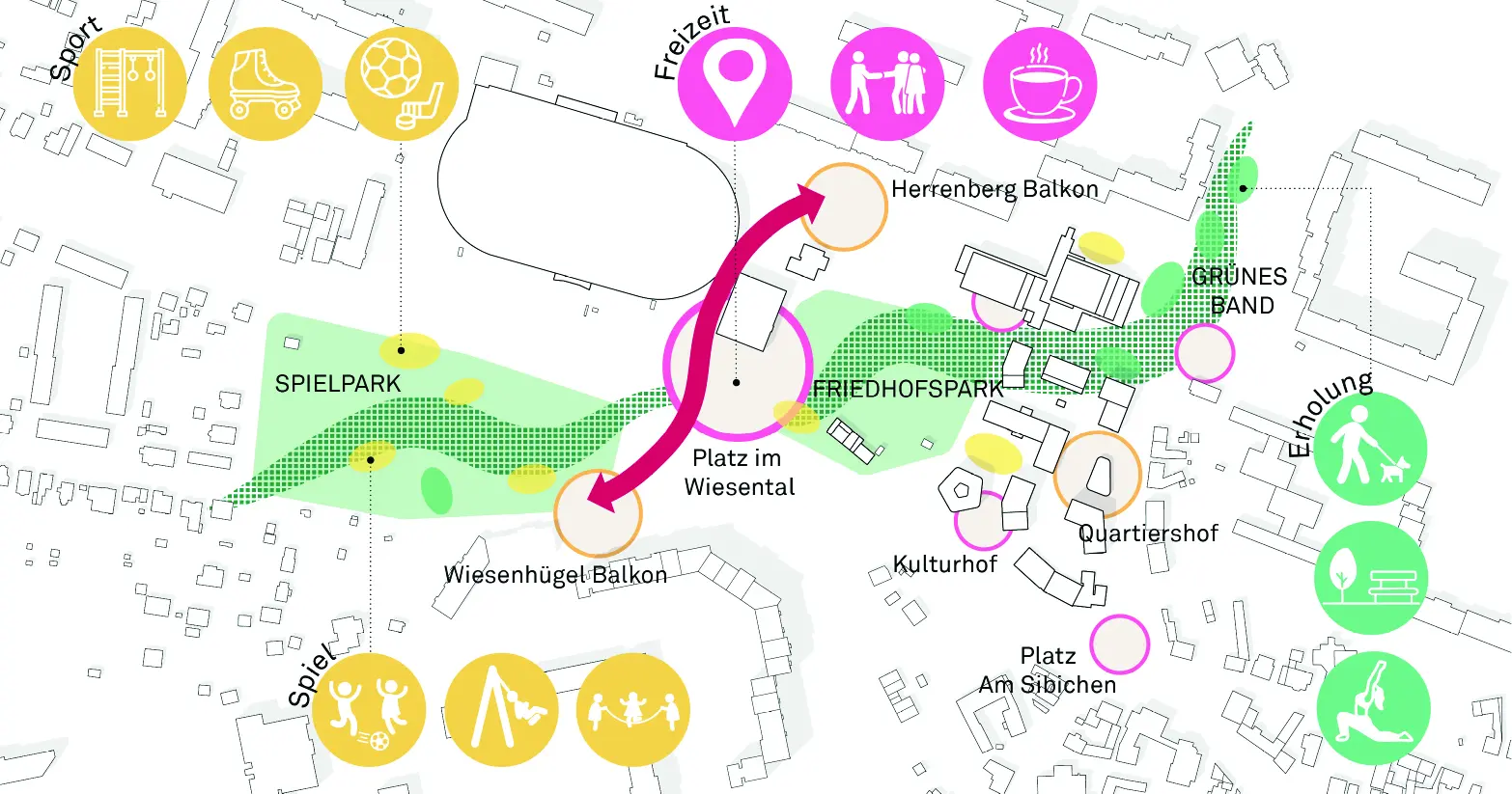
This green spine connects the bridge plazas, the central civic square, neighbourhood parks and activity spaces into one coherent landscape system. It provides orientation, strengthens identity and establishes a new hierarchy in which public space—not infrastructure—defines the character of the district. The landscape concept was explicitly developed to transform a fragmented urban structure into a continuous, climate-resilient green framework centred on a curving landscape boulevard that connects all public spaces across the different levels.
A New Civic Heart
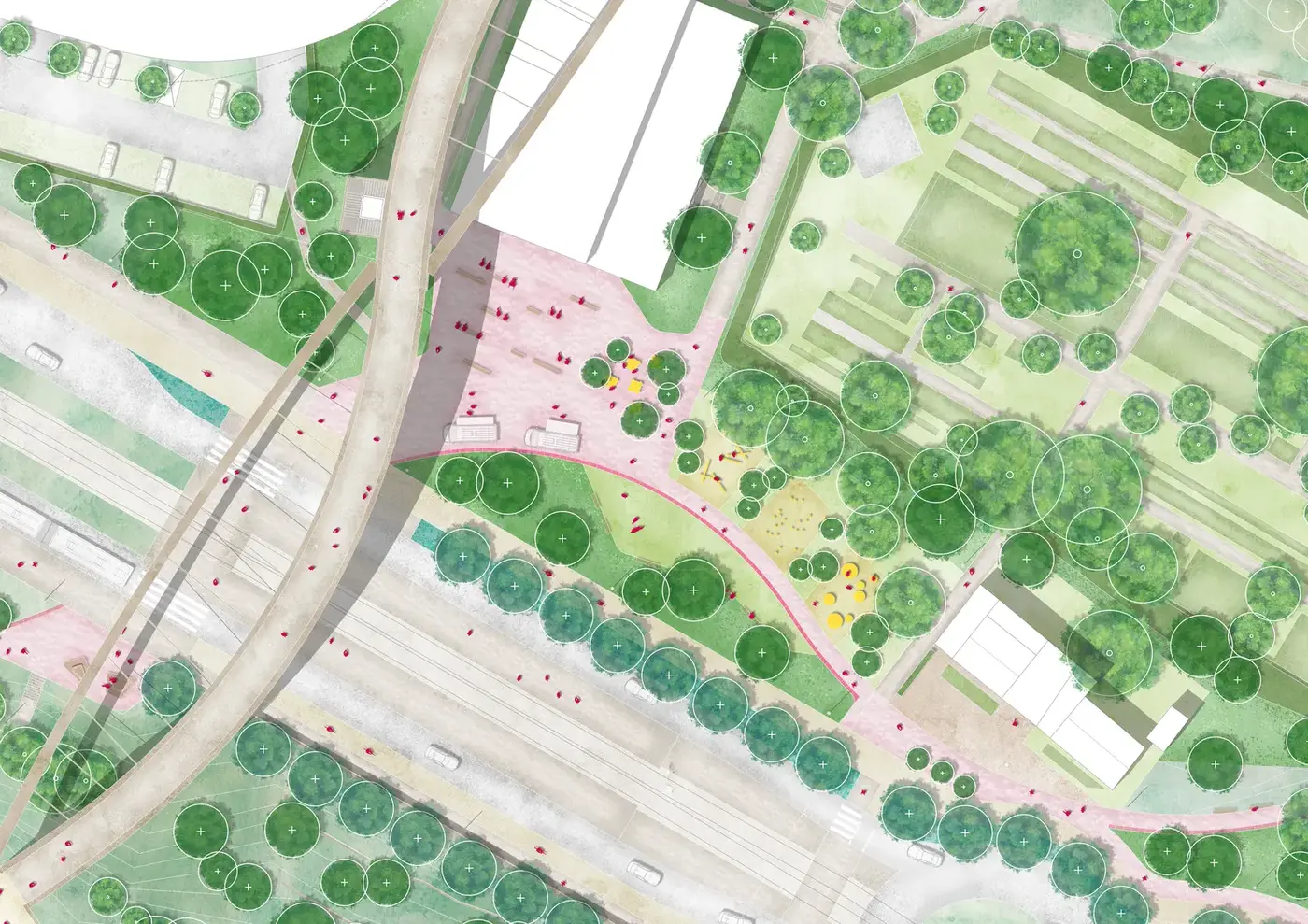
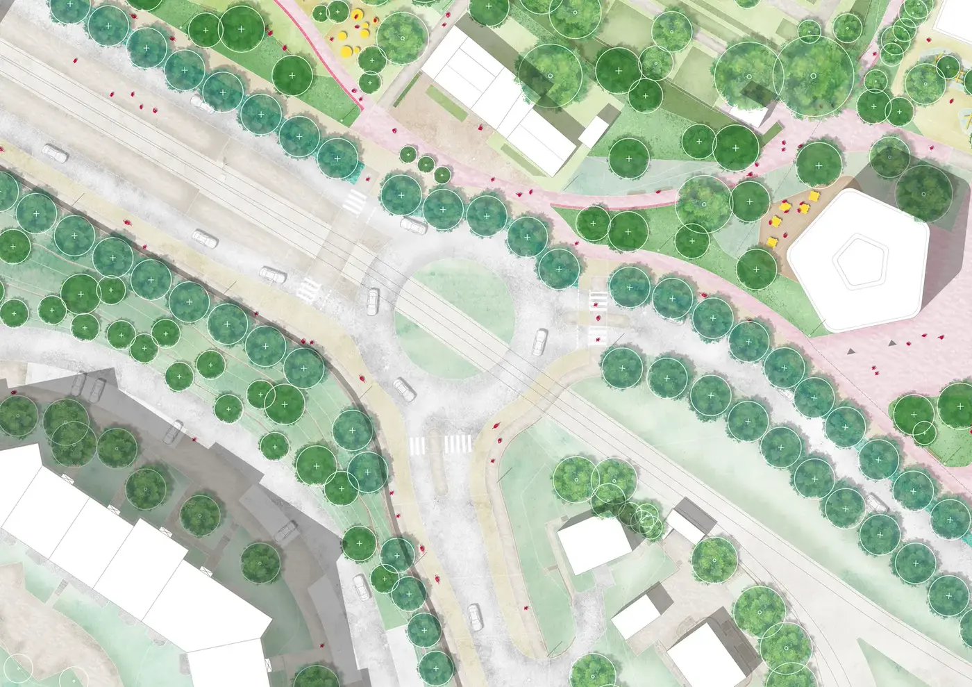
At the centre of the proposal lies the Neue Mitte Platz, positioned around the future tram stop Abzweig Wiesenhügel.
Rather than functioning simply as a transport interchange, the square is conceived as the everyday meeting place of the district—a place where movement, social interaction and civic life overlap.
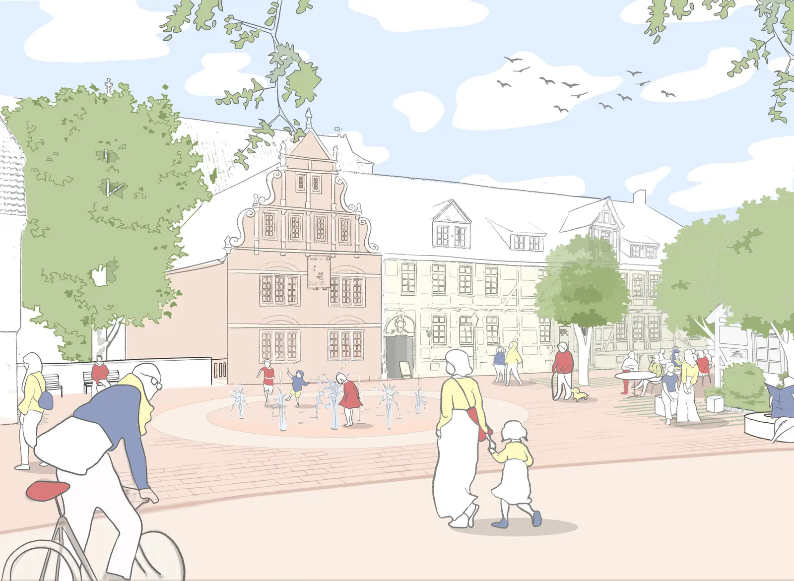
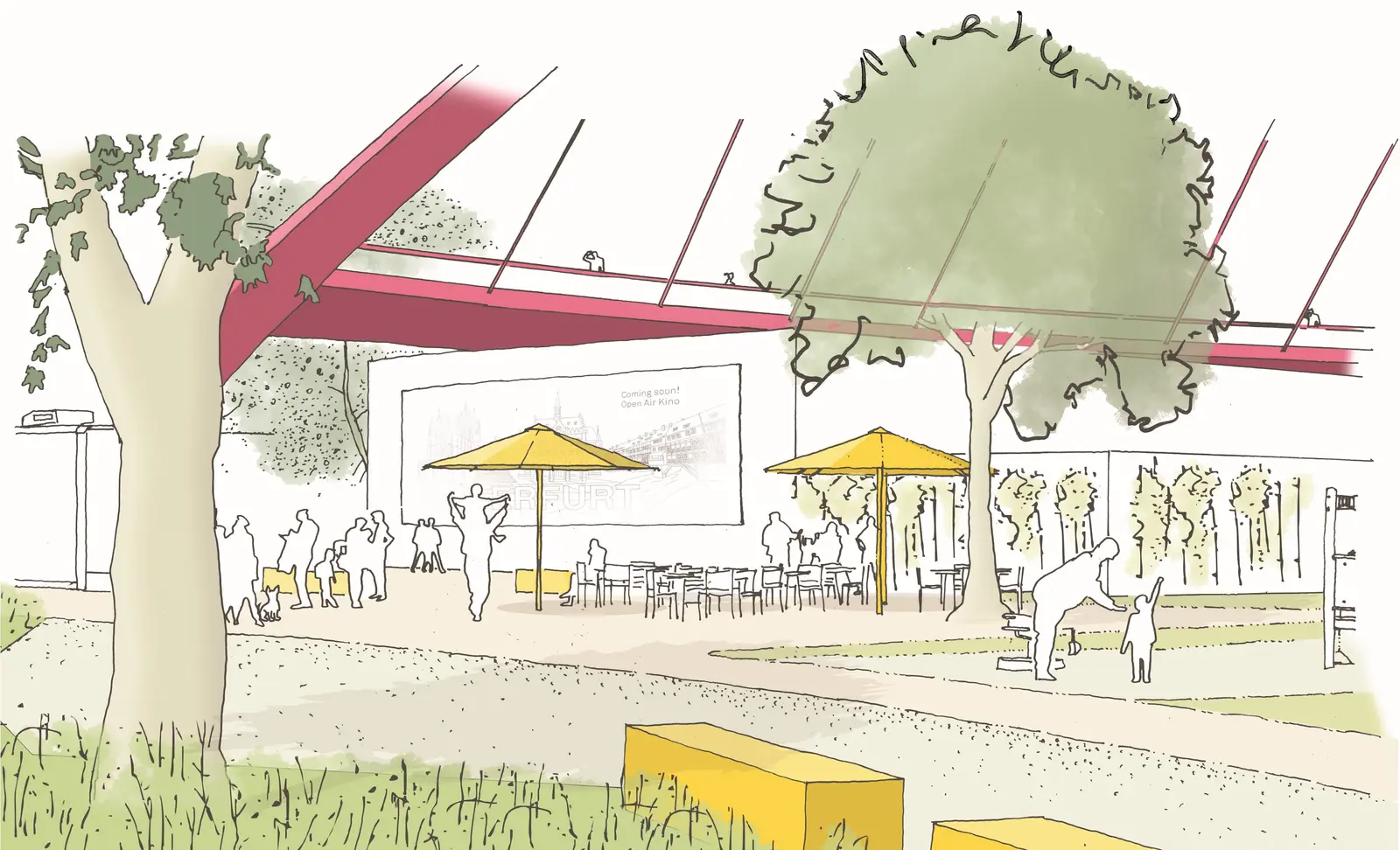
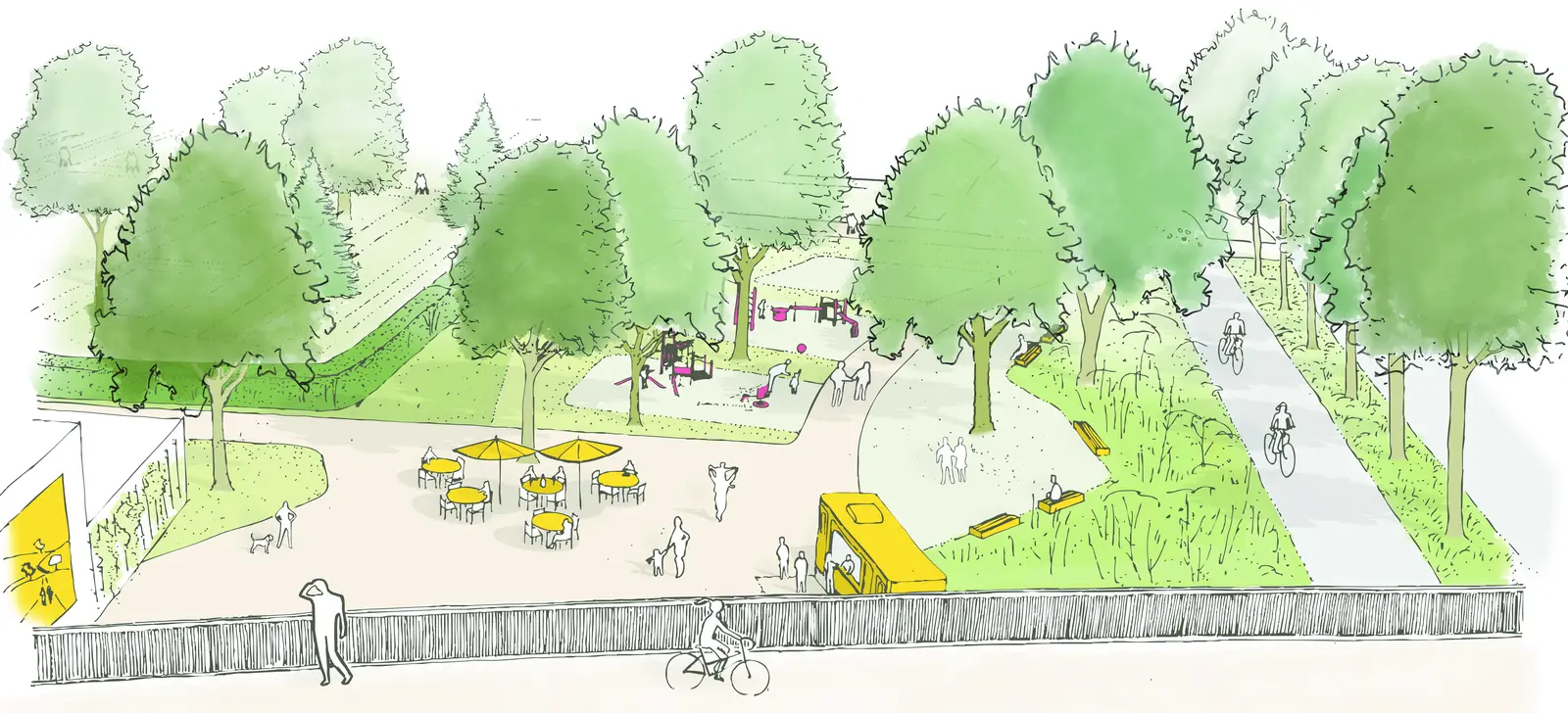
The square connects the surrounding sports facilities, neighbourhood centre, cemetery, commercial areas and residential districts through a flexible public realm that accommodates both daily routines and seasonal events. Open lawns, generous planting, temporary market spaces, outdoor cultural events and community activities allow the square to evolve throughout the year while remaining welcoming to all generations.
Instead of creating a monumental urban space, the design creates a place that gains its identity through everyday use. The project description emphasises the square as the central node linking public facilities, transport and neighbourhood life, with flexible programming and landscape structure providing both activity and protection from surrounding traffic.
Designing Movement as Experience
Movement is treated not simply as circulation but as a landscape experience.
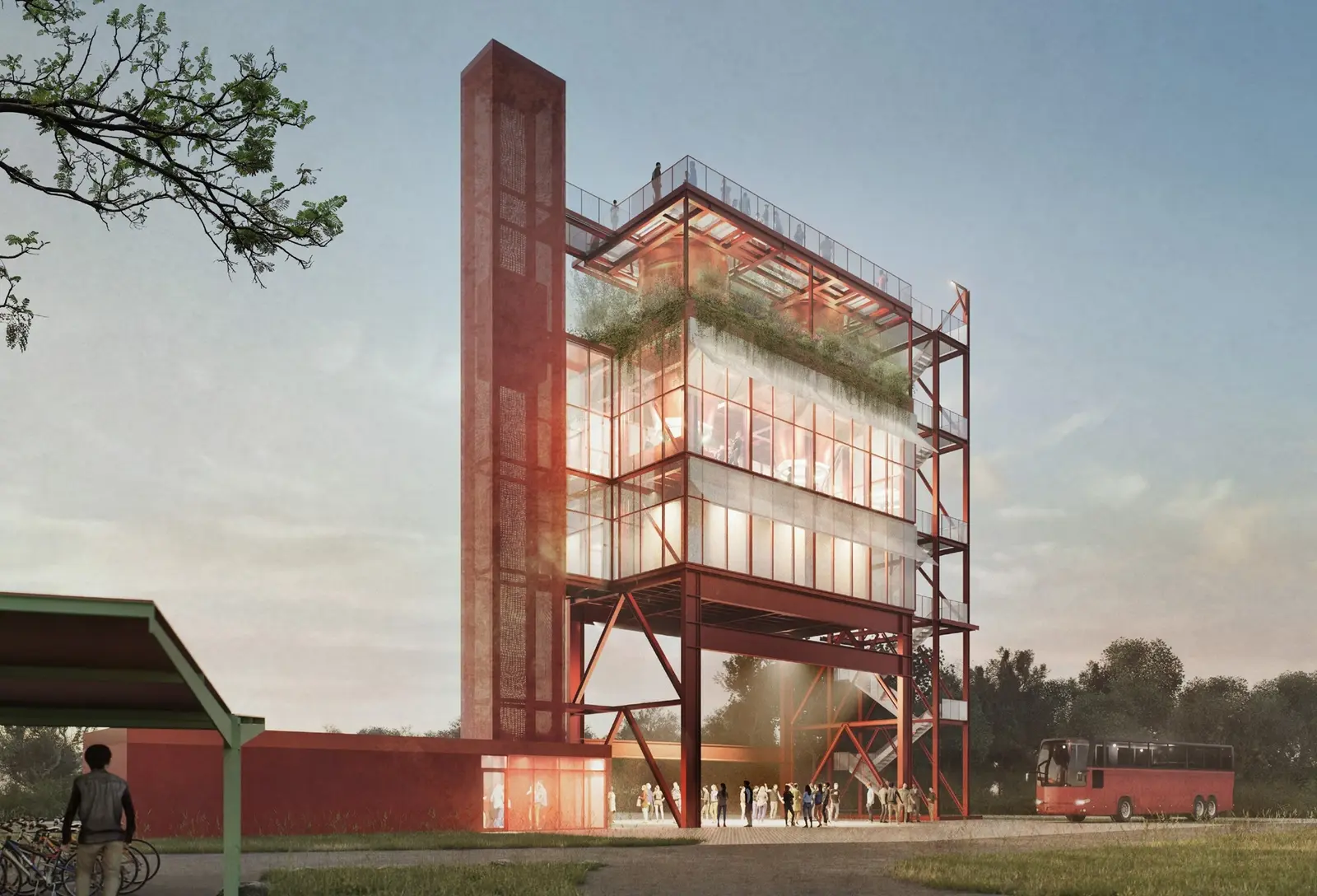
Two elevated bridge plazas mark the entrances to the landscape boulevard, each responding to its specific urban context. One creates a quiet green arrival framed by trees and planting. The other forms a more urban public terrace, incorporating sculpted seating and informal gathering spaces overlooking the district.
Throughout the project, accessibility is seamlessly integrated into the landscape. Ramps, terraces and gradual transitions replace abrupt level changes, allowing people of all ages and abilities to move comfortably through the site while experiencing the changing topography of the valley.
The project demonstrates that accessibility can become an integral part of spatial identity rather than merely a technical requirement.
Landscape as Climate Infrastructure
Climate resilience is not introduced through isolated technical interventions but embedded within the overall landscape structure.
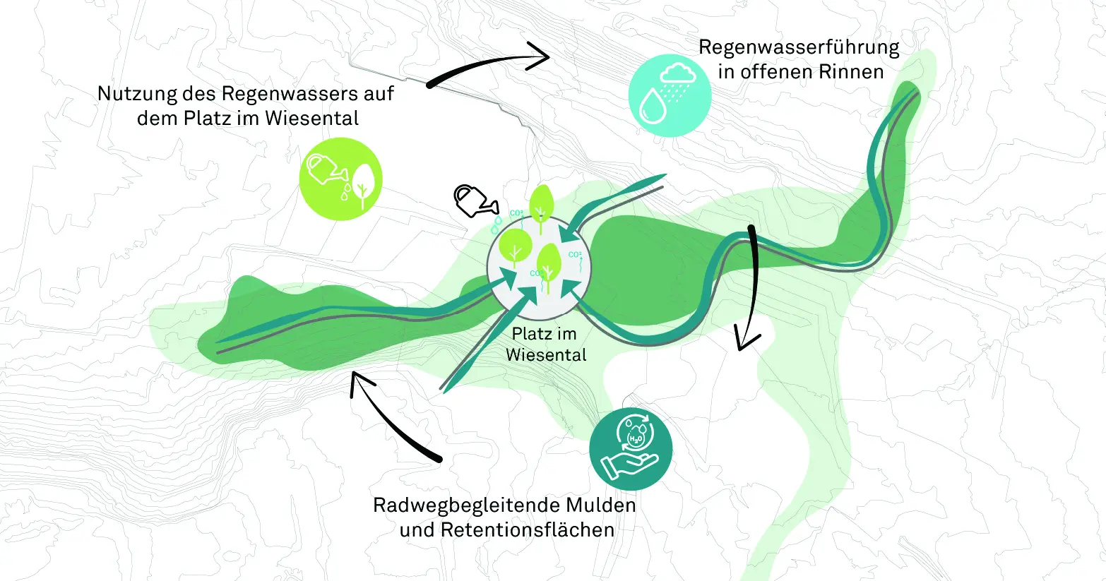
Water, vegetation, soil and public space operate together as interconnected environmental systems.
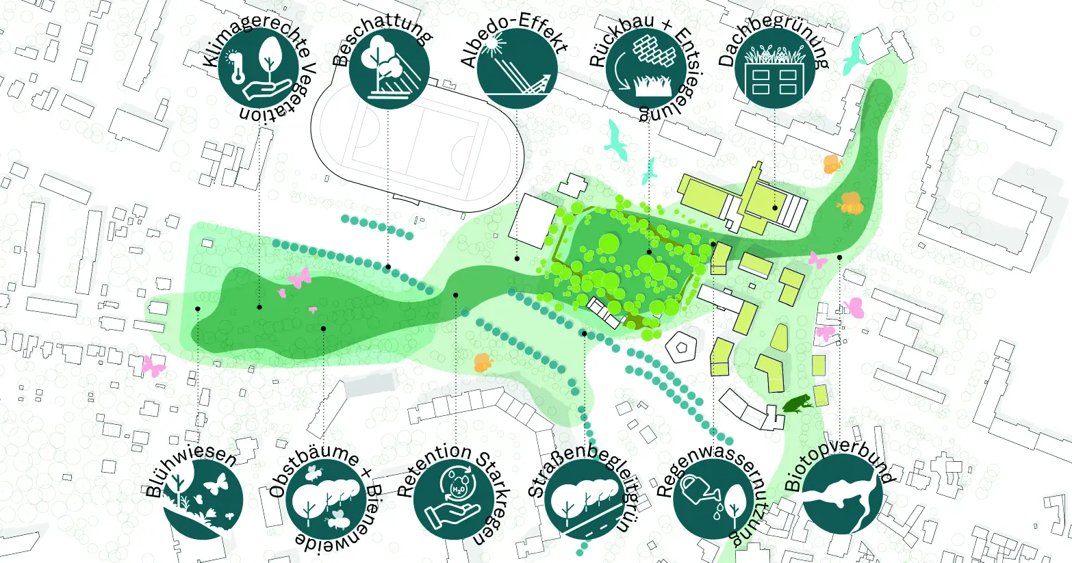
Existing mature trees are retained wherever possible and complemented by climate-adapted planting communities that increase shade, strengthen biodiversity and improve the urban microclimate. Species-rich meadows, shrub habitats, insect hotels and nesting opportunities contribute to a more diverse urban ecosystem while reinforcing ecological connectivity across the site.
Rainwater is managed according to Sponge City principles through permeable surfaces, bioswales, rain gardens and retention areas that reduce runoff, support groundwater recharge and create visible water-sensitive landscapes. Particular attention is given to areas with a history of flooding, where decentralised rainwater management becomes both an ecological and spatial design element.
Rather than separating environmental performance from urban design, the proposal integrates both into one coherent landscape strategy. The report highlights biodiversity, climate-adapted planting, permeable surfaces, bioswales, retention measures and climate adaptation as integral parts of the landscape concept.
Designing for Everyday Life
Successful public spaces cannot be fully programmed.
They succeed because they allow people to make them their own.
The proposal therefore establishes a robust spatial framework rather than prescribing fixed uses. Along the Landscape Boulevard, activity zones alternate with quieter gardens, open lawns and neighbourhood spaces that encourage spontaneous occupation and adaptation over time.
Children, commuters, older residents, cyclists and visitors all experience the landscape differently, yet remain connected through a continuous public realm designed to support everyday life rather than isolated events.
The project recognises that resilience is not only environmental. It is also social.
A resilient city is one in which public space encourages encounter, inclusion and shared ownership.
Beyond Urban Regeneration
Neue Mitte Südost is more than the redesign of a transport junction.
It proposes a different understanding of urban transformation.
Rather than allowing infrastructure to divide neighbourhoods, the project demonstrates how landscape can become the medium through which fragmented urban systems are reconnected. Ecology, mobility, public space and climate adaptation are not treated as separate disciplines but integrated into one resilient landscape framework.
The result is not simply a new park or a new square.
It is a new relationship between landscape and the city.
My Contribution
As Landscape Design Lead, I was responsible for developing the overall landscape architecture concept and translating the urban ambitions of the project into a coherent public-space strategy.
My work focused on establishing the landscape framework that reconnects the surrounding neighbourhoods, developing the concept for the Landscape Boulevard, integrating climate adaptation and Sponge City principles, shaping the ecological strategy and defining the spatial character of the public realm.
Working within an interdisciplinary team alongside Kortemeier Brokmann Landschaftsarchitekten, INVER GmbH and engineering specialists, I coordinated the landscape design to ensure that movement, ecology and public life formed one integrated spatial system.
Throughout the design process, my objective was to place landscape at the centre of the urban transformation—not as an element surrounding infrastructure, but as the infrastructure that reconnects the city itself.
Project Information
- Client
- City of Erfurt
- Location
- Erfurt, Germany
- Year
- 2025
- Project Type
- Competitive Dialogue according to §18 VgV – Model Project for Urban Regeneration
- Result
- 2nd Prize
- Role
- Landscape Design Lead
- Services
- Landscape Architecture · Public Realm Design · Climate Adaptation · Sponge City Strategy · Biodiversity · Urban Landscape Design
- Partners
- Kortemeier Brokmann Landschaftsarchitekten · ensphere GmbH · INVER GmbH – Transport Planning
Credits
Plans, diagrams and sketches © ensphere GmbH, Kortemeier Brokmann Landschaftsarchitekten and INVER GmbH.
All drawings and images remain the property of the originating offices.